3D/2D Inspection Design Reverse Engineering and Automation
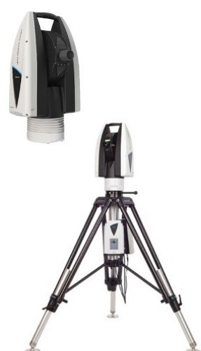
Laser Tracker
Rental and Inspection Services
Geo Informatics has been specializing in laser tracker inspection for over a decade. Our expertise spans inspecting components ranging from 300 meters to 100 meters in size, serving industries such as aerospace, automotive, defense, and renewable energy. With a track record of delivering reliable solutions, we have earned the trust of more than 50 customers nationwide.
Why choose Geo Informatics?
Geo Informatics stands out as the exclusive service provider utilizing the Leica AT 960 laser tracker for inspection services. Recognized globally as a trusted premium brand, Leica sets the standard for laser tracker technology.
Additionally, Geo Informatics is among the few providers equipped with a comprehensive suite of tools, including the SMR, T-Probe, and scanner, integrated with the laser tracker.
What accessories does Geo Informatics has for its Laser Tracker?
Geo Informatics offers the following accessories with its laser tracker to enhance inspection capabilities:
SMR (Spherically Mounted Reflector): A standard laser tracker accessory used in applications like leveling and precise measurement tasks.
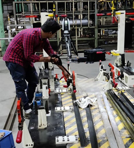
Leica T-Probe: Ideal for probing components and accessing areas beyond the reach of the SMR. The T-Probe is essential for creating features with edges, such as radii and diameters, and for measuring geometric dimensions and tolerances (GD&T) like circularity, parallelism, and runout. It is the perfect tool for complex measurements on geometric profiles.
Leica Scanner: Designed for inspecting non-geometric profiles by comparing them against CAD models, the 3D scanner is the ideal solution. It is also indispensable for generating CAD models from 3D point cloud data, making it the go-to tool for capturing detailed surface profiles.
How does Geo Informatics Price their Laser Tracker service?
Geo Informatics Prices its laser trackers either on
Project bases (Hired services)
Per day bases (Man and Machine Rental)
What is a Laser tracker and how does it work?
Laser trackers determine the position of a point by measuring angles and distances. They emit a continuous laser beam toward a retroreflective target, such as a Spherically Mounted Reflector (SMR), which is placed on or touches the object to be measured. The SMR reflects the laser beam back to the tracker at a precise 180-degree angle, ensuring the beam retraces its path. This data is then used to calculate the coordinates of the point in the X, Y, and Z planes.
This technology is not limited to SMRs but extends to touch probes and scanners:
Touch Probes: The laser tracker can track touch probes, such as L-probes and T-probes, using the same principles. These tools enable inspection in areas inaccessible to the SMR and are invaluable for creating profiles like circles, which require multiple edge points for accurate measurement.
Scanners: Laser trackers also support scanners, which generate 3D point cloud data of a part. This data can be used to create 3D CAD models or compare the scanned profile against an existing CAD model, producing a detailed color comparison report.
This versatility makes laser tracker technology a powerful tool for precision inspection and modeling.
What is the range of our Lecia laser tracker?
The accuracy and range of a laser tracker typically depend on the number of times it needs to be repositioned. Geo Informatics’ AT 960 laser tracker offers exceptional capabilities, measuring up to 20 meters using an SMR and 10 meters with a probe without requiring repositioning. When the tracker is shifted, the measurement range extends to an impressive 100 meters.
What applications Geo Informatics has done with laser Tracker -
Our range of applications includes:
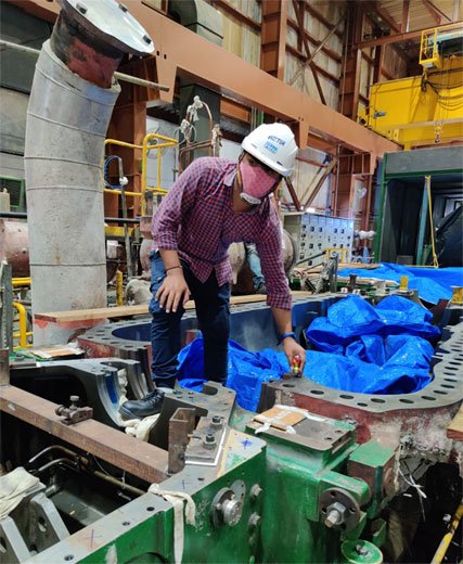
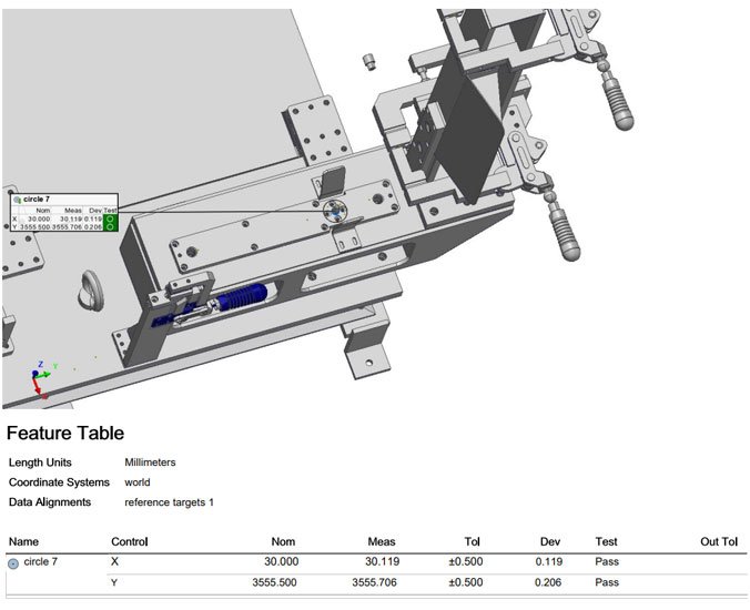
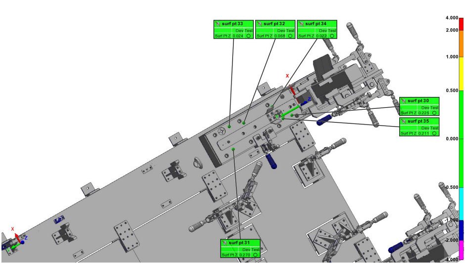
Deploying and inspecting fixtures in automotive assembly lines
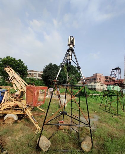
Leveling fixtures for precise alignment
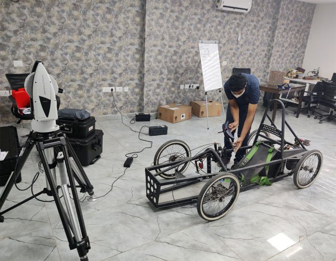
Reverse engineering special-purpose vehicles
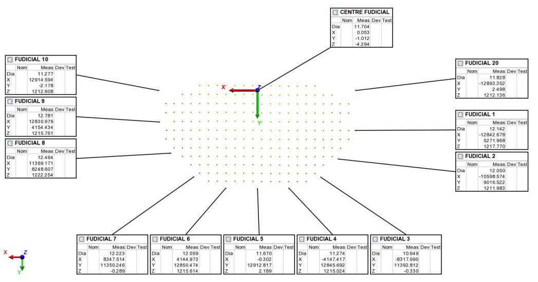
Inspecting circularity on large vehicles
Aligning large subassemblies and assemblies
Inspecting large turbine blades and similar components
And much more.
How to decide when to use a Laser tracker rather than a Portable CMM.
With expertise in both laser trackers and portable CMMs, Geo Informatics recommends using a laser tracker for inspecting parts exceeding 4-5 meters in length. For measurement ranges between 5 meters and up to 100 meters, laser trackers provide the most effective and accurate solution.